The best hunting app isn't the one with the most features. It's the one you've already set up, paid for, and downloaded to your phone before you lose service on the two-track. Every season somebody drives 900 miles, hikes into a drainage, and then discovers their maps won't load because they never cached them offline. Don't be that hunter.
Here's the truth nobody selling you a subscription will say out loud: no app kills anything. They just help you make faster, smarter decisions about where to be and when. So instead of ranking apps like a leaderboard, let's do something more useful and sort them by the job they do. Get one app for each job, learn to actually run it, and you'll out-plan hunters carrying twice the gear. Pair your app stack with the physical kit in our out-of-state hunt essentials before you leave the driveway.
Job 1: Mapping & land ownership (the one app you can't skip)
If you buy exactly one hunting app, buy a mapping app. Knowing precisely where the public-private line falls has saved more hunts, and prevented more trespass tickets, than any other tool on your phone. This is the category that pays for itself the first time it keeps you off a landowner's back forty.
- onX Hunt is the category standard: color-coded land ownership (BLM, USFS, state, private), landowner names, offline maps, waypoints, tracking, and 3D terrain. Pricing as of 2026 runs $34.99/yr for a single state, $49.99/yr for two states, and $99.99/yr for the Elite tier covering all 50 states plus Canada. If you hunt out of state, Elite is the one you want.
- HuntStand is the strongest alternative, with deeper whitetail-specific tools like stand and property planning and hunt-area management. Popular with folks who hunt the same private ground year after year.
- BaseMap is a clean-interface option with solid public/private overlays worth a free trial if the other two don't click for you.
How to actually use it: Don't wait until you're standing at the trailhead. The night before, open the app on Wi-Fi and download offline maps for the whole area you might roam, not just your first spot. Drop waypoints on parking, gates, glassing knobs, and the exact public/private corners you'll walk near. Then flip your phone to airplane mode and confirm the map still draws and your GPS dot still moves. Your phone's GPS chip works without cell signal; your maps don't, unless you cached them. Cross-reference boundaries with the managing agency's website too, because line data can lag a recent easement or closure by a season.
Job 2: Unit research & draw odds (Western hunters)
Out West, the hunt is half-won at the kitchen table in the spring. Draw-odds and unit-research tools turn a wall of state regulations into a shortlist of units you can actually draw and actually kill on. Read our guide on how to draw an elk tag in the West alongside these tools.
- GoHunt Insider is the workhorse: draw odds by point count, trophy potential, harvest statistics, 3D scouting maps, a point tracker, and a filtering tool that lets you sort hunts by odds, public-land percentage, and trophy quality at once. Indispensable for elk, mule deer, antelope, sheep, and goat.
- Huntin' Fool adds a human element: consultative unit advice and a member magazine for hunters who'd rather talk it through with a person.
- Toprut is the budget option for hunters who just want clean draw-odds numbers without the extras.
How to actually use it: Work backward from your point count, not from the trophy photos. Filter for units where your current points give you a realistic draw, then read three seasons of harvest data before you get attached to any one unit. A "trophy" unit you can't draw for a decade is a fantasy; a good unit you can draw this year is a hunt.
Job 3: Weather & wind (your highest-leverage read)
Reading wind correctly is the single most valuable thing a deer or elk hunter does all day, and the stock weather app on your phone won't cut it. You need wind direction and gusts by the hour, not a sun-with-a-cloud icon. Pair this with our guide on when to start scouting for fall to see how weather and seasonal patterns stack up.
- Windy gives you hour-by-hour wind direction, gust forecasts, and pressure trends, with a free tier that's plenty for most hunters.
- Scoutlook and its ScentCone feature draw your scent plume right onto the map so you can pick a stand that keeps your wind off the bedding.
- HuntWise and dedicated hunting-weather tools layer wind and temperature alerts on top of movement forecasts.
How to actually use it: Check the forecast the evening before and pick your stand based on the wind you'll have at first light, not the wind right now. In hill country, remember thermals override the forecast: cool air sinks downhill at dawn and dusk and rises as the ground warms mid-morning. Read the hourly wind on the app, then overlay it on the terrain map and hunt the seam where the prevailing wind and the thermal both carry your scent away from where you expect deer to come from. If you can't get a clean wind, don't burn the spot.
Job 4: Solunar & movement timing
Solunar tables predict peak feeding windows from the moon's position (major and minor periods). Treat them as a tiebreaker, not gospel: when weather and solunar line up, that's when you sit all day. A cold front dropping into a major feeding period is the kind of thing that makes veteran hunters call in sick.
- Standalone apps like iSolunar and various "Solunar / best hunting times" calendars do one job and do it cheap.
- DeerCast blends solunar with weather and pressure into a plain deer-movement forecast.
- Most mapping and weather apps (onX, HuntStand, Windy) now bake solunar tables in, so you may already own this without a separate download.
How to actually use it: Don't reorganize your whole hunt around the moon. Use it to decide which days to grind. If a major period falls at legal light and a front is moving through, plan an all-day sit. If solunar is weak and the weather is flat, that's your morning to scout or run cameras instead of burning a good stand.
Job 5: Ballistics & shot placement
A ballistic app turns your rifle from a 200-yard tool into a confident 400-yard one, but only if you feed it honest data. Garbage in, gut-shot out.
- Hornady 4DOF is a free, genuinely accurate calculator that models axial drift and aerodynamic jump instead of relying on a generic ballistic coefficient.
- Strelok Pro is the long-range favorite: steeper learning curve, deep customization once you dial it in.
- Applied Ballistics is the standard for serious precision-rifle shooters chasing the last click.
How to actually use it: Chronograph your actual load and enter your real muzzle velocity, sight height, and zero, then confirm the app against paper before you trust it on an animal. Verify your drops at 300 and 400 yards on a range day; if the dope on the app matches your targets, believe it. Update the environment before each hunt, because a 4,000-foot change in elevation or a 30 degree F temperature swing moves your point of impact more than most hunters realize.
Job 6: Scouting, trail cams & backcountry safety
This is where digital scouting meets the real world. Cellular trail-cam ecosystems send images straight to a companion app, so you can pattern a buck's movement from your couch and save your boot-scouting for the spots that matter. And when you leave cell coverage entirely, communication stops being a convenience and becomes a safety issue.
- Cellular trail cameras pair with their own companion apps (Spypoint, Tactacam Reveal, and others) that push time-stamped photos to your phone with the wind, temperature, and moon phase attached, so you can spot the pattern, not just the picture.
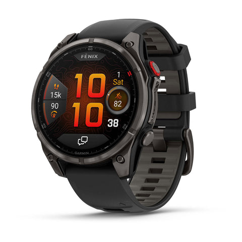
- For off-grid hunts, a device with two-way satellite messaging and SOS is the non-negotiable. A GPS watch like the Garmin Fenix 8 Pro with phone-free calling and satellite SOS puts messaging, tracking, and an emergency beacon on your wrist with multi-day battery, so a rolled ankle two ridges deep doesn't turn into a headline.
How to actually use it: Set your cam alerts to batch a few times a day instead of pinging you on every raccoon, or the notifications become noise and the battery dies. For satellite comms, send a test check-in from the truck before you walk in, share your tracking link with someone at home, and agree on a "if you don't hear from me by X" plan. Technology fails; a person who knows your plan doesn't.
Don't drain the one battery that runs all of it
Every app on this list depends on a phone that's alive at last light. Cold weather murders battery, and a dead phone means no map, no wind, no GPS, no SOS. So run the phone lean: airplane mode when you don't need signal, screen dimmed, background apps closed, and the phone carried in an inside pocket against your body, because a cold battery reports a false low and shuts down hours early. Then carry a field charger and a short cable, and top it off the night before every hunt. On where to buy that charger, we'll save you a click: Venator does not stock power banks, and we do not stock hand warmers either — not the rechargeable kind, not the disposable shake-to-heat packets. Neither is a category we carry, and there is nothing in our lineup worth pointing you at as a stand-in, so pick both up at an electronics counter or a big-box sporting goods store. What you will find with the rest of our hunting accessories is the gear that keeps the phone dry, secured, and on your body in the first place, which is the half of this problem we can actually help with.
The lean 5-app starter stack
Don't subscribe to ten things. If you're building from zero, run this:
- onX Hunt Elite for mapping and land ownership.
- GoHunt Insider for unit research if you hunt out West, or HuntStand if you're whitetail-focused on familiar ground.
- Windy for wind and weather.
- Hornady 4DOF (free) for ballistics.
- A satellite-capable device or GPS watch for off-grid safety and tracking.
That's five tools covering every job that matters. Add a solunar or trail-cam app only once the core five are second nature.
Mistakes I see most
- Downloading the app at the trailhead. Offline maps, unit data, and dope all need to be cached at home on Wi-Fi. Do it the night before, every time.
- Trusting property lines to the inch. Line data is very good but not perfect near recent easements. When you're within a few yards of a boundary, give yourself margin.
- Never confirming ballistics on paper. An app's drop chart is a prediction until your targets agree with it. Verify at 300 and 400 before you believe it on game.
- Letting the phone die. No charge, no tools. Airplane mode, a dim screen, and a power bank are cheaper than a blown hunt.
- Chasing features instead of the job. Ten half-learned apps lose to five you can run in the dark with gloves on.
Your move this week
Before your next hunt, run this 20-minute drill at the kitchen table: pick your unit in your mapping app, download the offline maps, drop waypoints on parking and two backup spots, then put your phone in airplane mode and confirm the map and GPS still work. Pull tomorrow's hourly wind and pick which of those spots the wind actually lets you hunt. Charge your power bank. Do that and you'll walk in with a plan instead of a hope. Then stock up on the physical side of the kit in our out-of-state hunt essentials before the trip.
Frequently Asked Questions
What is the best hunting app?
It depends on the job. For offline mapping and land ownership on public land, onX Hunt is the standard, with HuntStand and BaseMap as strong alternatives. For Western draw odds and unit research, GoHunt Insider leads. For wind, Windy. Most serious hunters run at least two: a mapping app and a dedicated wind app.
Is a paid mapping app worth the subscription?
For public-land and out-of-state hunters, yes. onX Hunt's Elite tier runs $99.99/yr for all 50 states plus Canada as of 2026, and land-ownership accuracy that keeps you off private ground pays for itself the first time it prevents a trespass problem. If you only hunt one piece of private ground you already know cold, the value is lower.
Can I use hunting apps without cell service?
Yes, but only if you download offline maps to your device first, at home on Wi-Fi, before you lose signal. Your phone's GPS chip works without cell service; the map imagery does not unless it's cached. For extended backcountry hunts, carry a satellite-capable device as a backup for both navigation and emergencies.
Which apps are best for weather and wind?
Windy gives hour-by-hour wind direction and gusts, and Scoutlook visualizes your scent cone on the map. Whatever you use, cross-reference the hourly wind against your terrain map to predict thermals, which override the forecast at dawn and dusk in hill country.
Do I need a ballistics app, and is a free one good enough?
If you shoot past 250 yards, yes. Hornady 4DOF is free and genuinely accurate, but any calculator is only as good as the data you feed it. Enter your chronographed muzzle velocity and confirm the drops on paper at 300 and 400 yards before trusting them on an animal.